Weather
This is a quick guide to weather forecasts for (relatively inexperienced, probably pre-solo) glider pilots. It is written with OUGC’s home airfield (big, flat, grass airfield that’s with no mountains or coast nearby) in mind.
Tip #1: you miss 100% of the flying days you’re not at the airfield! Flying might take place for part of the day, if not all of the day.
Tip #2: it’s only a forecast, the weather is not guaranteed, but forecast accuracy increases greatly two days in advance.
This guide might help you decide if a day will be ‘flyable’ or ‘soarable’. It is not intended to inform cross-country task-setting. On the day, the decision to fly or not to fly rests with the Duty Instructor. Flying in a range of weather conditions in all seasons will keep you current and also make you a better pilot. Learning to find lift on a 0.5 knot day will sharpen your senses. Other factors will also inform ‘flyable’: pilot experience, aircraft and launch type. An early solo pilot in a K8 (wooden glider) is different to an instructor flying in their own fibreglass glider. There are days when the K8 will stay in the hangar but you could fly in the K21 with an instructor. The Duty Instructor will supervise and brief appropriately.
The two weather forecasts that we introduce here are the MetOffice forecast and RASP (Regional Atmospheric Soaring Prediction). These are FREE to access and the format is reasonably friendly for beginners.
What we mean by ‘flyable’: an ok/good training day for flying circuits and flying with instructors. We get good high launches at WOTG, over 2000 ft if the wind is moderately strong. So a slightly sunny winter day with a brisk wind can deliver great value for student pilots even if it’s cold.
It is ‘unflyable’ when:
the wind is too strong or ‘gusty’ (rapid changes in wind speed and direction, this increases the risks with launching and landing)
the clouds are too low (visibility is poor - you can’t fly in fog!)
it’s raining (gliders are not permitted to launch in the rain, it compromises their aerodynamic performance and restricts visibility). We can work around/fly around localised showers though, by pausing launches as appropriate.
it’s snowing (snow on the ground probably OK)
it’s hailing (ow!)
What we mean by ‘soarable’: a day with thermals and conditions for local soaring. Most likely April - September. For a sense of ‘soarable’, you should use RASP.

Part of a RASP forecast for a nice autumn training day. Cloudbase lifting throughout the morning, and <15 kts wind. Windspeed shown as the black numbers at the top of the plot, with wind direction indicated by ‘WNW’ etc and black arrows.
As you progress in gliding, you will learn more about the weather. Indeed meteorology is part of the Bronze exam. There are also additional forecasting tools such as SkySight that you can explore.
MetOffice
The MetOffice forecast doesn’t provide a soaring prediction but it is familiar to a lot of people already. Kidlington is the closest location to RAF WOTG. The parameters to check are:
visibility: ‘VP’ (very poor), ‘P’ (poor), ‘M’ (medium) not good. ‘G’ (good) is ok, ‘VG’ (very good) or ‘E’ (excellent) are better!
windspeed: select ‘knots’ as the unit, >20 kts and it is probably unflyable.
wind gust: select knots as the unit, >25 kts and it is probably unflyable.
precipitation etc. A day that is 90% rain all day is not going to work, but rain/showers can (and do) clear up, so a forecast showing a few hours of sun, a bit of rain, some more sun could be a good training day. We can work around/fly around localised showers.
rain radar is fun to look at and shows you what weather is on the way.
If the MetOffice has a yellow/orange/red warning out for rain, wind, snow, a storm: that sounds unflyable!

Screenshot from MetOffice website showing Kidlington forecast for the same day as the RASP plot above. This shows a good training day: basically no rain, light winds, bit of sunshine and good visibility.
RASP
RASP stands for Regional Atmospheric Soaring Prediction. It produces a series of BLIPMAPS (Boundary Layer Information Prediction MAP) which are forecasts specific to a local area and the ‘boundary layer’ of the atmosphere where convection/thermals happen.
Go to https://rasp.stratus.org.uk/index.php/rasp-by-turn-point and select ‘BIC - Bicester Control Tower’ or ‘WOG Weston-on-the-Green’ as the turn point. RASP forecasts are available 7 days in advance, but the accuracy becomes much higher 2 days in advance. Click ‘get results’.
RASP will give you HEAPS of information, let’s focus on just a few parameters:
cloudbase: <1000ft and visibility will be quite poor, >1800ft it’s probably flyable!
windspeed: RASP shows gusts, a day showing >25 kts throughout the day is marginal at best, likely unflyable.
RASP Stars: scroll down the page to the second last chart. This gives you an idea of the soaring potential of the day, a 4 or 5 star day will see plenty of action at the gliding club! A 3 star day and there will be some thermals around … but can you find them?
The MetOffice forecast has been refined and interpreted by meteorologists for everyone to read on their phones. RASP hasn’t had this “editing”, and can show you strange or ‘buggy’ results. RASP also doesn’t (directly) show you if there is rain coming. A cloudbase of negative 500ft doesn’t make any physical sense and probably indicates fog.
A soaring day will generally have some wind, surface heating (i.e. a good amount of sunshine hitting the ground), some cumulus and a high(er) cloudbase 2500ft +. A great soaring day will have more surface heating (probably a warmer day), even higher cloudbase, cumulus (or it could be ‘blue’ i.e. thermals but no clouds to mark them) … and more stars on RASP!
There are many more parameters and plots on RASP that are of interest. For example, vertical windspeed can be used to map out wave lift; however, wave is extremely unlikely at RAF WOTG!
for more information on interpreting rasp, how it works, and details of various parameters see the below guide from the rasp uk site.
there is so much more to weather than what’s written here, but hopefully you find the above helpful!
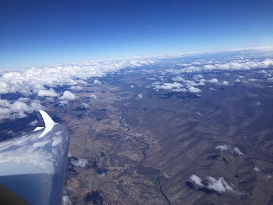
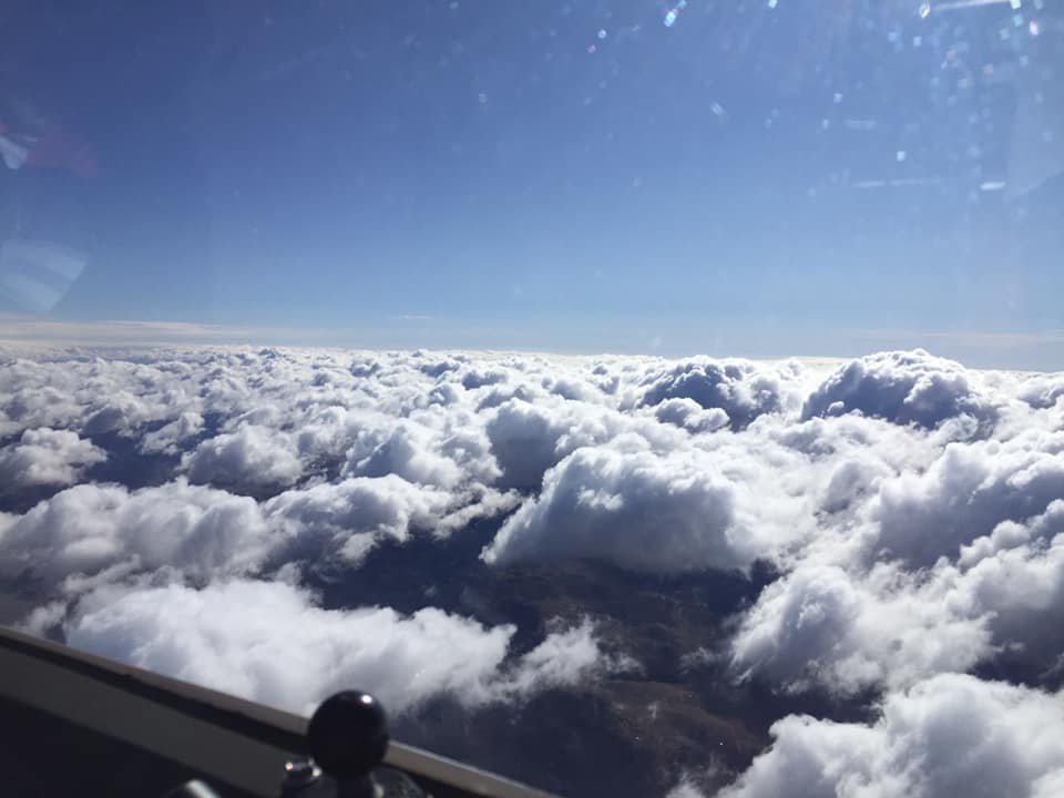
Snowy Mountains wave in Australia. Max altitude reached on this flight 18500ft AMSL!